


List of relic sites (27)
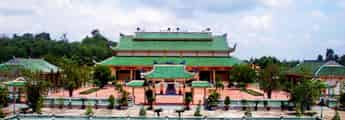
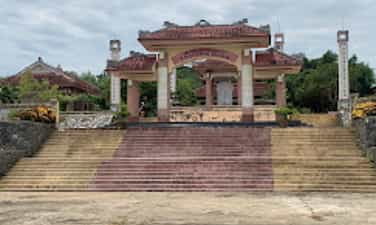
Ong Pagoda
Ong Pagoda (Quan Thanh Tu) is located in the town of Tu Thu Xa, Nghia Hoa commune, Tu Nghia district, 10km from Quang Ngai city to the east. The pagoda was made by 4 states of Hoa Minh Huong (Fujian, Trieu Chau, Hainan, Guangdong) living in Thu Xa Kien area in the second Minh Mang year (1821) and has undergone 4 restoration in 1881, 1894, 1920, 1991. Ong Pagoda worships Quan Vu in the main hall, worshiping Avalokitesvara Bodhisattva (people of China and Vietnam called Buddha Quan Am Nam Hai) in the harem space in the model of "Money Holy Buddha". In addition, the harem also worshiped Thien Hau, Kim Dau and 12 midwives. In terms of scale, although Ong Pagoda seems humble compared to the temples worshiping Quan Cong in Hoi An (Quang Nam), there is a harmonious combination of flower -Vietnamese architectural elements in a whole rich aesthetic. According to the profile of the General Museum of Quang Ngai province, the pagoda has a total area of 2,730m2, including temple garden, Tam Quan, pagoda yard and pagoda. All are surrounded by round 1, 1.2m high, 0.5m thick in a parallel style. The pagoda turned to the east. From the outside, the architectural works are arranged on a trary axis, tightly layout, posted in sequentially including: Tam Quan, Binh Phong - Tieu Tieu, Trong - Bell floor and temple. On both sides of the facade, there are two low gates, behind the temple is the temple to worship Tieu Dien Sy. Tam Quan gate structured one space, four columns, two sets because of the anti -fruit, in the way of the diaphragm. The third diaphragm bends the shape of the boat decorated with the head of the phoenix tail. The diaphragm is linked through the husbands and gloking through the column head. The roof of the tam tile roofed with yin and yang tiles, the top of the boat bent the boat, decorated the dragon shape, the tail covered with vegetable vines. The roof is decorated in the form of a box with five decorative cells. The two sides of the three gate are the temple of Ba Thien Hau. Battan Phong 2m high, with three compounds, the front covered with tiger shaped tiger bared the tail to look very vivid, the back covered the shape of the glass on the roof cluster. On both sides of Binh Phong are two pillars. Bell floors, drum floor built posted through the axis. Ong Pagoda currently holds 6 steles, epitaphs of Han characters, created in 1895 (7th Thai Thanh), 1920 (5th Khai Dinh), which are the years when the temple restores. Decorative stone stele touches the dragon painting in the forehead, the brazen beer is decorated with the dragon's head wrapped in a vegetable vine. The epitaph records the list of people who worship the money, including the name of the person, the place of residence, and the amount of money. In general, the art of decoration at Ong Dat Pagoda is quite sophisticated, especially the technique of embossing, touching, puncturing, touching on the screen, wooden walls, worshiping, trap, pattern, husband, statue, briefcase ... Ong pagoda has a harmonious combination of architectural elements of Vietnamese and Chinese people. In addition to the main components and materials of the traditional communal house in the Central region (the baseballs' husbands, the fake husband's husband) also has the appearance of the hiding of the planet of the Northern Delta and the set of the pumpkin husband's style of the North China style. Ong Pagoda was recognized by the Ministry of Culture and Sports (now the Ministry of Culture, Sports and Tourism) to recognize the national monument under Decision No. 43 of the Culture/Decision on January 7, 1993. Source of Quang Ngai Electronic Information Portal.
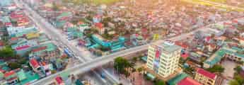
Quang Ngai
3364 view
Rating : National relics.
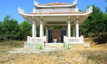
Truong Dinh Temple
Truong Dinh Hero is a famous hero in Vietnamese history in the fight against the French colonialists in the period from 1859 to 1864. Truong Dinh was born in Tu Cung village, Quang Ngai province. He followed his father to the South and established Tan An and Dinh Tuong. Truong Dinh led the army to raid the French plantation after the French army attacked Gia Dinh in 1859. However, when the court signed the Nham Tuat Peace Contract in 1862, yielding to three Eastern provinces to France, Truong Dinh Dinh Do not accept the beach and take office in An Giang as the court's order. Instead, he continued the war with the title of Binh Tay Dai Marshal, with the support of the people and the Confucianists. His fight against French was shocked with many illustrious feats. However, on August 19, 1864, in the dark leaves in Go Cong Dong, Truong Dinh was seriously injured. In order to preserve the honor, he decided to commit suicide at Pond Dinh, Go Cong, causing his people and soldiers to be heartbroken and regretful. After Truong Dinh died, King Tu Duc awarded the title and built a temple in Tu Cung village, Quang Ngai to commemorate him. Truong Dinh Temple, currently located in Khe Thuan hamlet, Tinh Khe commune, Quang Ngai city, Quang Ngai province, is the place to worship the national hero Truong Dinh. The temple was ranked by the People's Committee of Quang Ngai province in 2014, and recognized as a national historical monument on February 24, 2023. Source of Quang Ngai Electronic Information Portal.
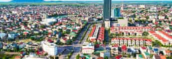
Quang Ngai
3609 view
Rating : National relics.
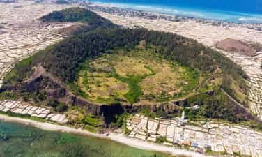
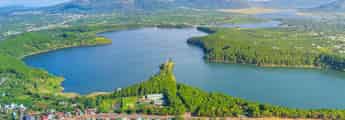
Gieng Tien mountain relics
Gieng Tien and Thoi Loi volcano are two unique mountains in Ly Son Island, Quang Ngai, belonging to the group of 10 volcanoes discovered in this area. Gieng Mien volcano, 86m high, has hundreds of meters wide, covered with fertile red soil and green all year round. At the foot of the mountain is Chocolate Pagoda, with the statue of Quan The Am 27m high, considered to protect fishermen at sea. Standing from the top of Gieng Tien Mountain, you can see the panoramic view of Ly Son Island and see the baby island in the middle of the sea. Gieng Tien Mountain, also known by the locals, is located in the territory of Tay village, An Vinh commune, Ly Son island district, Quang Ngai and is the second largest volcano on the island. This volcano has a height of 90m, an area of about 0.45 km2 and the diameter of the operating range is 500m. This volcano has a very round and pointed mouth shape, like the image of a coin, also because of this special shape that the locals have named the Gieng Tien mountain. Gieng Tien Mountain also has geological characteristics similar to Thoi Loi volcano, when undergoing erosion, creating stone walls, which the people used to create steps to lead to the crater. Gieng Mount Mountain was formed from a prehistoric period of about 3,000 to 4000 years ago. Therefore, this mountain has witnessed extremely prominent events of the geological formation process on the island. Since then, the landscape and geology here are also very special, this place has each layer of ashes falling into the debris that has accumulated when volcanoes operate on the slope of the volcano and almost no ruins of Sea ink on the cliffs. Because of the geological creation over time, the walls of the volcano here have also been worn out to create a beautiful scenery not inferior to the commercial - Thoi Loi. During the advanced sea, the peak of the mountain was also submerged in the sea in different stages when the cliffs were worn out, revealing very beautiful sections. A very strange thing is that although the co -volcano money on Ly Son Island has a very fertile red soil, there is no species that can grow on it. Explaining this, the people of the island district think that this is a sacred land, so the trees cannot grow on it. People also brought this sacred land to work as the core of the windy tombs scattered throughout the region. In January 2020, Mount Gieng Mon Mountain was decided by the Ministry of Culture, Sports and Tourism to be one of the national historical sites. Source of websites of Ly Son district, Quang Ngai province.
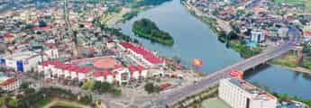
Quang Ngai
3819 view
Rating : National relics.
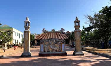
An Vinh communal house
Dinh An Vinh relic was built in the late 18th century, located in Ly Son Island, Quang Ngai. The communal house is not only a place to store traditional culture and sacrifices, but also an important symbol of Vietnam's sovereignty over islands and islands. An Vinh communal house has many times witnessed historical events, from separating An Vinh ward Cu Lao Ré to wars with the French colonialists and the American imperialism. Not only is the place to store antiques, An Vinh Dinh relic is also a place to record historical marks with Hoang Sa team, a team of fishing soldiers to protect the sovereignty of the sea and islands. This is also the starting point of the family of Vo Van, Nguyen, Pham Quang, Le, Vo Xuan, Dang, famous families participating in Hoang Sa team. The architecture of the communal house with the three -shaped and decorated patterns of the four spirit, the five Phuc shows the belief that pray for peace for the people. An Vinh village communal house is not only a spiritual symbol for the people of Ly Son island, but also an important historical monument of Quang Ngai, a testament to the sovereignty of Vietnam's sea and islands on the two archipelagos of Hoang Sa and Truong Sa. . In 2013, the Ly Son Quang Ngai relic was recognized by our State as a national historical monument. Source of websites of Ly Son district, Quang Ngai province.
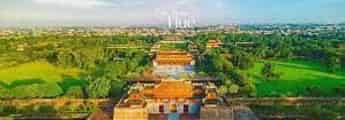
Quang Ngai
3552 view
Rating : National relics.
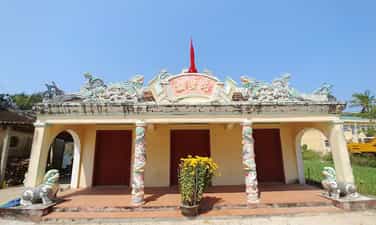
Dinh An Hai
An Hai communal house is located on Ly Son Island, Quang Ngai Province. The communal house is the place to worship the gods and money of Ly Son Island. Thereby showing the relationship between Vietnamese culture on ancient Chama culture. An Hai communal house was built in 1820. Therefore, the communal house has a design style, ancient and solemn architectural architecture. An Hai communal house was built by 8 Tien Hien family and the villagers together to build the communal house. However, later Le was eliminated from the list of money due to violations of the communal house. From 1820 to now, An Hai communal house has experienced many additional constructions and built more projects. Therefore, the current architecture of the communal house has changed a number of changes compared to the original. The communal house was built with the direction of the sea, behind the Thoi Loi mountain and in front of there were two pillars with the nghe placed on the top. The architecture inside An Hai communal house includes Tien Duong, Hau impregnated and decorative details such as gongs, drums, and soul altar. The communal house has a layout style in the concept of Yin and Yang, showing the desire to peace through the design and decoration motifs of Mesopotam, Long Phung, Ngu Phuc ... Despite many changes, but the relic of Dinh Dinh An Hai still retains the unique beauty, typical of ancient architectural style, showing the solemn and ancient communal house. In 1995, An Hai communal house relic was ranked as one of Quang Ngai historical sites recognized as a national historical monument. The web portal of Ly Son district, Quang Ngai province.
Quang Ngai
3377 view
Rating : National relics.

Cao Cao 601 revolutionary historical relic
17 km north of Kon Tum town along Highway 14, there is a place that many of us know, which is Doc Dau Skull. Skull Slope is a new folk name that came into existence after the war in April 1972 between the revolutionary army and the enemy. The Ba Na people in this area call that place Kon Loong Pha, which means a slope with many Trac trees and High Point 601 is a military term for the enemy's military base on K-Rang Loong Pha hill. Until early 1972, the high point was still an important military point of the enemy, including artillery and tank positions arranged on two saddle-shaped hills. In the north, there is Ha Mon Security Station, guarded by the 23rd Security Battalion, with reinforced armored vehicles. In the south, there is the 3rd Airborne Brigade Headquarters, a large artillery field, tanks, and armored vehicles. There are also enemy artillery positions and Security posts in Kon Trang K-la; Ironing yard; North of Kon Tum town... With an important military strategic position, capturing high point 601 means controlling most of Kon Tum town as well as the entire Dak To - Tan Canh region. Capturing High Point 601 means completely mastering strategic road 14, the northern section of the Central Highlands. Realizing the importance of High Point 601, we were determined to capture it, and on the enemy side, they also tried to defend themselves by all means. On April 10 and 11, 1972, with the spirit of determination to fight and determination to win, we won a big victory at High Point 601. Results obtained: Destroyed 2 enemy armored squads, a convoy of goods, destroyed Destroyed 28 vehicles (including 14 tanks, M113 armored vehicles and 14 transport vehicles), destroyed 72 tons of military equipment and supplies, destroyed a security platoon, severely damaged 2 parachute companies, suffered heavy losses. Damaged the headquarters of the 23rd Airborne Brigade, a mortar battlefield, destroyed hundreds of enemies, shot down 2 planes, destroyed 2 106.7 mm mortars, captured more than 15 guns of all kinds, we cut off completely route 14. Together with local soldiers and guerrilla militia, this was a highly effective traffic cutting battle of the 28th Regiment in the Spring - Summer 1972 campaign in the Central Highlands. Since the signing of the Paris Agreement (from early 1973 to 1975), the area of High Point 601, KRang Loong Pha Slope (Skull Slope) and the entire Dak La and Ha Mon area have been disputed areas between us and the enemy. . Many fierce political struggles took place here, sometimes even using military weapons to win every inch of land with the enemy: With the correct policies of the superiors combined with intelligence, strategy and the heart Through the courage of our army and people, despite many hardships and sacrifices, we were able to maintain the entire liberated area of Dak To - Tan Canh to Dien Binh and Ha Mon and control the Dak La area, contributing to liberated Kon Tum town in the spring of 1975. Over the past years, Kon Tum General Museum has listed relics throughout the province, of which High Point 601 is a revolutionary historical relic that is of great interest to provincial leaders as well as the Culture sector. Recently, the Provincial Museum has compiled a scientific profile for the High Score 601 historical site to request a ranking. Although late, this is a truly meaningful work. More than 30 years after the victory of High Point 601, due to human impact and the harsh natural environment, the relic is only a vestige, but it is still convincing. Revolutionary historical relic High point 601 was ranked as a provincial-level relic by the Provincial People's Committee on May 17, 2003. Source: Dak Ha district information portal
Quang Ngai
5356 view
Rating : Provincial level relics
Truong Luy Quang Ngai
Truong Luy is a special relic with a total length of 127.4km, of which 113km is in Quang Ngai province. Quang Ngai Truong Luy Monument (ranked as a national relic on March 9, 2011), passes through the districts of Tra Bong, Son Tinh, Son Ha, Tu Nghia, Minh Long, Nghia Hanh, Ba To, Duc Pho. Truong Luy is a special type of large-scale relic, with closely related and inseparable relics such as ramparts - ancient roads - fortress/guard system and natural landscape. Truong Luy was built with materials mined on site such as hill soil, field soil, natural stone with many techniques of embankment, soil compaction, masonry, stone stacking... very typical of residents of the plain along the foot of the mountain. and the mountainous areas west of Quang Ngai. Because the ramparts are long and go through many different terrains, on flat terrain, the ramparts are built with soil, while on steep mountain slopes, the ramparts are built with soil on the inside and stone on the outside. Truong Luy relics in the high mountain area are still almost intact, especially the ramparts built of stone. According to researchers, across the ramparts, there are more than 70 relics of forts/fortresses built of stone or earth surrounded by moats. Most of these relics are still intact, including forts/fortresses such as Thien Xuan in Hanh Tin Dong commune (Nghia Hanh), Kim Long fort/fortress in Hanh Dung commune (Nghia Hanh) with quite large areas. According to relic records, the average height of Truong Luy Quang Ngai is 45m. Nghia Hanh district has the highest point with over 200m, mainly in passes and hills such as Phuoc Loc pass, in Hanh Nhan commune (Nghia Hanh) with 221m, Chim Hut pass in Hanh Dung commune (Nghia Hanh) with 227m... Terrain characteristics of the ramparts in Quang Ngai mainly run along the foot of the mountain and the back of the low hill. According to researchers, Truong Luy is a boundary but not a closed boundary. The floodway cuts across many rivers and streams, each crossing has a gate, guarded by a guard, allowing travel between the two sides. Travel is mainly for economic exchange purposes (Hre people buy salt, Vietnamese people buy rice, cinnamon and forest products), especially the market network located on the Vietnamese side. During peacetime, these posts/guards were the checkpoints for controlling trade and tax collection between the two regions. This is a special cultural feature of the monument. Archaeologists believe that this was not only a structure built for defense purposes, with military elements, but also a trade route between the lowlands and the uplands, between the mountains - plains and the sea. . In addition to its cultural and historical value, Truong Luy relics also have potential for tourism development, with ancient roads next to a long rampart, passing through residential communities with beautiful villages. , preserving many cultural identities of the nation. Source: Quang Ngai Electronic Newspaper
Quang Ngai
4883 view
Rating : National monument
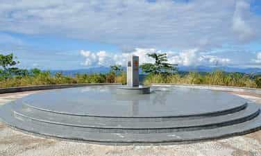
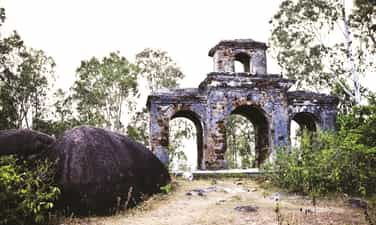
Indochina junction
The Indochina junction is not only famous during the resistance war against the US, but today this place is becoming very attractive to tourists on their journey to visit Kon Tum - the northernmost tip of the Central Highlands of Vietnam. The place of the Indochina junction on the majestic Truong Son range has always been in the memories of soldiers and young volunteers on their way to the Southern battlefield, battlefield C (Laos), battlefield K (Cambodia) over the years. Unforgettable war. This is the land known as the rooster crowing that all three countries hear together. Now this land is becoming one of the attractive tourist destinations for domestic and foreign tourists. Where places have gone down in history such as the Indochina junction (where Truong Son West road meets Truong Son East road during the resistance war), historical relics of the victory of Dak To - Tan Canh in April 1972; The border marker was jointly built by the three brother countries Vietnam - Laos - Cambodia on a mountain top 1,000m above sea level, about 30km from Playku town. This milestone was constructed by Kon Tum province in December 2007 under the supervision of experts from three countries sharing a common border. Representatives of the three countries' Ministries of Foreign Affairs held a solemn inauguration ceremony on January 18, 2008. The special milestone weighs 900 kg, is made of triangular cylindrical marble, is 2 meters high, and on each side of the milestone facing each country is attached the national emblem, the year the milestone was installed and the country's name in red letters of the government. that country. This is the second milestone marking all three countries to be placed on Vietnamese soil. The first milestone is the unified construction of the three countries Vietnam - Laos - China in A Pa Chai (Dien Bien). From the border junction marker, visitors have the opportunity to see the panoramic view of the Indochina junction land. Also here, tourists who want to visit Laos and Cambodia can complete exit procedures at the Vietnam border station at Bo Y international border gate. Source: Kon Tum Tourism
Quang Ngai
5935 view
Rating : National monument

Chu Mom Ray National Park
Chu Mom Ray National Park is located in Sa Thay and Ngoc Hoi districts (Kon Tum province). Right next to Chu Mom Ray National Park is Cambodia's Virachey National Park and Laos' Southeast Ghong Conservation Area. The flora of Chu Mom Ray National Forest is rich and diverse in species and status. There are about 1,534 plant species here, including 113 rare species belonging to the orchid family, gymnosperms, dioecious species, cycads, cycads, bamboo pine, rosewood, rosewood... The fauna of Chu Mom Ray National Park records 718 species, including 115 species of mammals, 275 species of birds, 41 species of reptiles and amphibians, 108 species of freshwater fish, and 179 species of insects. Among them, there are 124 rare species listed in the Red Book of Vietnam and the world, typically: red-cheeked gibbons, Truong Son muntjacs, gaurs, Indochinese tigers, elephants, black bears, fire leopards..., false lizards. 4 new stripes, white-edged snake, daisy-fronted snake..., hornbill, peacock, earth eagle... This place once marked many fierce battles during the period of "cutting Truong Son to save the country". Some places in the forest still have traces of trenches, bomb craters... The total area of Chu Mom Ray special-use forest is about 54,583.59 hectares; production forest 1,665.64 hectares; buffer zone 188,749 hectares. Including Bo Y and Sa Loong communes (Ngoc Hoi district); Ro Koi, Sa Nhon, Sa Son, Mo Rai, Ya Xier, Sa Thay town (Sa Thay district. This is where ethnic minority communities live, notably the Gia Rai and Ro Mam people. The proud point of the National Park is that there are 114 species in the Vietnam and world red books. In particular, the grassland (Ja Book valley) is the largest in Vietnam (more than 9,000 hectares) and has attracted many important species of ungulates and carnivores such as Truong Son muntjac, wild buffalo, tiger, etc. gaur, bison, elephant, black bear, fire leopard... and hundreds of species of reptiles and amphibians. In addition, on high mountain peaks such as Ngoc Linh, Ngoc Tu Ba, Chu Mom Ray peak... are home to many species of primates and arboreal animals such as gibbons, langurs, and precious birds such as hornbills. , land eagle, peacock… This is one of 94 special-use forests in Vietnam, with the largest area of primary forest and containing rare genetic resources. In 2004, Chu Mom Ray National Park was recognized as an ASEAN Heritage by the Association of Southeast Asian Nations. Source: Vietnam National Tourism Administration
Quang Ngai
5720 view
Rating : National monument

Mang Den historical relics and landscapes
Mang Den eco-tourism area is located in Mang Den town, Kon Plong district, Kon Tum province. Mang Den is a cluster of enemy strongholds, located on Road 5 from Kon Tum to Quang Ngai, now Highway 24, about 55 km northeast of Kon Tum city. This is a cluster of enemy bases deep in our liberated area. Surrounding the base is a complex system of dense obstacles with 10 layers of barbed wire and 2 layers of fence. Alternating between the layers of fence are anti-infantry mines, anti-tank mines and a trough-shaped trench 4m wide, 2.5m deep, densely planted with spikes. Inside were hundreds of blockhouses made of reinforced concrete and earthen wood, with tunnels connecting the fortifications and three corners with three mother blockhouses made of solid reinforced concrete. In mid-1974, the Kon Tum Provincial Party Committee and the B3 Command advocated attacking and destroying enemy bases to expand the liberated area and create momentum for the temporarily occupied Kon Tum area. After a period of preparation, at exactly 5:30 a.m. on October 3, 1974, the Commander of the 28th Infantry Regiment, Division 10, Army Corps 3 ordered to open fire to attack the enemy headquarters. At 7:55 a.m., our firepower simultaneously hit all targets. After a short time of developing the attack, at 10:45 a.m. we completely took control of point M12. Faced with the attack power of the H16 and H29 forces, the main force of the 28th Infantry Regiment and a number of our technical troops, on October 12, 1974, the enemy's last stronghold was located deep in the settlement area. The project in the Northeast of Kon Tum was completely wiped out. With the Mang Den victory in October 1974, our troops destroyed the enemy's last stronghold deep in our liberated area, breaking the enemy's safe corridor in the north of Kon Tum town, causing enemy troops to in the Northern Central Highlands battlefield was under strong threat. This victory liberated thousands of people and a large area of land, which was a great encouragement to promote the revolutionary actions of the people, especially ethnic minorities; At the same time, consolidate and build strong local government and armed forces. On the verge of victory, the armed forces surrounded the district capital of Mang But, liberating all the people in the area. Along with the victories at Dak Pet and Mang But bases, the Mang Den victory contributed to expanding the liberated area to Kon Tum town, creating new position and strength for the Central Highlands campaign, paving the way to liberate Saigon. , successfully ending the historic Ho Chi Minh campaign, unifying the country. Mang Den historical and scenic area was recognized as a national historical and scenic site on April 13, 2002. Source: Kon Tum Tourism
Quang Ngai
8195 view
Rating : National monument
Kon Hrinh evidence area
The evidence area of Kon Ho ring Church in Kon Ho ring village, Dien Binh commune, Dak To district, Kon Tum province is a place that marks the crimes of the American imperialists and the Saigon puppet government. Here, on the night of May 25, 1972, the US imperialists and the Saigon puppet government used planes to bomb and bomb the Kon Ho ring church and monastery, killing 500 innocent people and killing hundreds more. injured. More than 10 years ago, to commemorate the people who died due to the crimes of the American imperialists and the Saigon puppet government, Kon Tum province invested in building the Kon Ho ring Church relic area. The project is solidly built, with many main items such as: Memorial stele with content reflecting the crimes of the enemy, green campus, fence... After completion, the Kon Church Relics Area Ho ring has become a destination for local people as well as tourists inside and outside the province. Kon Ho ring Church is an outstanding religious architectural work in Dien Binh Commune, Dak To District, Kon Tum Province. Built in 1959, this church is the gathering place of the K'ho community, an ethnic minority living mainly in Kon Tum. Kon Ho ring Church stands out with its unique architecture, inspired by the traditional culture of the K'ho ethnic group. The temple roofs are made from bamboo and coconut leaves, creating a wild, rustic beauty that is no less impressive. Inside the church, paintings and statues of saints are carved on wood, creating a sacred and solemn atmosphere. Kon Ho ring Church is not only a gathering place for religious ceremonies but also a place to attract tourists and those who love culture and architecture. Visitors coming here will be able to visit, learn about the culture and history of the K'ho ethnic group and also have the opportunity to experience their life. In addition, Kon Ho ring Church is also a place where you can learn about the spiritual life of local people, as well as participate in religious activities such as festivals, seminars, and learn about ethics and lifestyle. nation's life. With its beauty and special historical and cultural value, Kon Ho ring Church has become a tourist destination not to be missed when you come to Kon Tum. Take time to explore and experience the feeling of peace and quiet at this location. Surely you will have memorable and meaningful experiences when you come to Kon Ho ring Church. Source: Kon Tum province information portal
Quang Ngai
5760 view
Rating : Provincial level relics
Bac Ai Pagoda
Bac Ai Ancestral Pagoda is located on Mac Dinh Chi street, Quyet Thang ward, Kon Tum city. The pagoda was built in the 8th year of Bao Dai (ie 1932 to 1933). Located on a high ground, the pagoda faces south, following Hue architectural style, Mon-shaped, including the Main Hall, Dong Lang, Tay Lang and Three Entrance Gate. Leader Vo Chuan, designed and urged both Kinh people and ethnic minorities to explore the jungle hill to build a pagoda, designed in the style of the word "Mon". In the year of the Goat, 1931, the Central provinces suffered consecutive droughts and crop failures, and people were hungry. Therefore, in the late years of 1931 and 1932, immigrants from the provinces of Hue, Da Nang, Quang Nam, Quang Ngai, and Binh Dinh flocked to the highlands and Kon Tum. During this migration, 70% died of starvation along the way, the remaining 30% reached the promised land. They cleared the forest for farming, but in this place they encountered many unforeseen things: wild animals, raging cobras biting countless people to death, people were confused and scared, night and night in this land, things happened. Many scary phenomena occurred. In 1932, Director Vo Chuan invited Mr. Hoang Thong, head of Bach Sa Pagoda, Quy Nhon, and the monks to go to Kon Tum to fast for 3 days to pray for the souls of unjustly deceased people. After the funeral ceremony, Mr. Vo Chuan asked Mr. Hoang Thong to prove his name Bac Ai. Charity is immense love, regardless of religion, Kinh people or Upper people. The pagoda was given the sign "The Four Bac Ai Tu" by King Bao Dai in 1933. In 1990, the pagoda was restored with the organization of the Venerable Abbot Thich Chanh Quang. Looking at the overall architecture, Bac Ai Patriarch Pagoda was built in the North-South direction, in Mon style, opening for that direction is the three-entrance gate, leading to the main hall in the center and the left and right sides are Dong Lang and Dong Lang. Tay Lang. The main hall consists of 3 rooms and 2 wings. The ancient building is divided into 3 compartments: front hall, middle hall, and upper hall. The roof is tiled, the brick walls are whitewashed, and the ceiling is covered with ceilings. The rafters, rafters, and columns all use precious woods such as purple star, rosewood, and redwood, elaborately and elaborately carved by Hue artisans. This space worships Tam The Buddha, Amitabha Tam Ton, Hoa Nghiem Tam Thanh... In particular, there is a stele recording the merits of French Captain Quenin and a wooden pillar symbolizing the 7 skulls of a Japanese officer who committed suicide at the pagoda yard at the end of World War II. Outside the main hall is Hoa Vien, where tombstones, towers, and shrines worship the God Emperor Bon Canh, Mountain God, Doan Quan and tru house are concentrated. Through many restorations, Bac Ai Ancestral Pagoda's original architectural features have been changed, and some unique sculptures such as flanking dragons and winding ropes are no longer there. The system of worship statues is covered with a layer of bright bronze, unable to retain its pristine beauty. However, a number of precious artifacts with visual artistic value such as the Statue of the Three Holy Mother Goddesses, the Guan Yin statue made of cracked ceramic, the Hoang Phi, the Couplet, the Ordination box, the Seal, etc. are still on display. subtle traces of time. Currently, Bac Ai Ancestral Pagoda is one of three communal houses (Vo Lam Communal House, Trung Luong Communal House, Bac Ai Ancestral Temple) that have been recognized by the People's Committee of Kon Tum Province as a historical-cultural relic. provincial level Source: Kon Tum Tourism
Quang Ngai
6096 view
Rating : Provincial level relics
Plei Kan victory
Plei Kan is located in Ngoc Hoi district, Kon Tum province. It is located in the north of Kon Tum province, on the eastern slope of the Truong Son range. A special feature of Plei Kan is that it is located at the crossroads of three countries: Vietnam, Laos and Cambodia. Plei Kan has an important history during the Vietnam War. Before 1965, Plei Kan was a large village of the Xe Dang ethnic group and other ethnic groups such as Brau, H Lang, and Kdong. Its strategic geographical position was recognized at the end of 1964 when the US decided to build a cluster of military bases here. Plei Kan in the language of the Xe Dang people is "big village". Before 1965, this was a place where the Xe Dang and Brau people lived in harmony in a peaceful village at the cross-border area of the three countries Vietnam - Laos - Cambodia. At the end of 1964, realizing the important strategic position at the Indochina border junction, the US puppet implemented a policy of gathering people to set up hamlets to isolate the people from the revolutionary forces, herding people to Dak Rnang village (Tan Canh, Dak To) established a strategic hamlet. In 1966, the US built Plei Kan into a military base located in the Indochina junction area (we often call it Plei Kan Base) to block the attack of our main army from the North and from Laos and Cambodia. The entire base has areas A, B, C, D, E, arranged continuously on 5 hills separated by 600 - 1,000 meters. In particular, area A is the central area. There is a tank detachment, a military airport, a field airport, 155mm and 105mm artillery positions, a system of underground bunkers, bunkers, hospitals, warehouses... The base is surrounded by 8 to 12 layers of barbed wire. Since 1969, here, there have been regularly 450 - 500 border rangers (95th Border Ranger Battalion) and 2 artillery companies of E 42 (Division 22) of the puppet regime. In early October 1972, the Central Highlands Front Command assigned the 10th Division the task of destroying Plei Kan Base. The 66th Regiment, the 37th Special Forces Battalion and most of the Division's artillery were ordered to attack. At 10:00 a.m. on October 12, 1972, from the surrounding artillery positions, our artillery continuously opened fire. All types of D74, 105mm, 155mm DKZ, B72 artillery, 106mm mortars... simultaneously bombarded targets in the base. Under the support of infantry, artillery and special forces, they cut the fence and opened the door. At 11:00 a.m., with strong support from artillery, tanks and infantry, we heroically rushed forward to capture the targets. The fighting in the base was extremely fierce. We and the enemy fought over each bunker, bunker, fortification... With a brave and tenacious spirit, after nearly a day and night of fighting, by dawn on October 13, 1972, we had complete control of Plei Base. Kan. As a result, we killed 404 enemies, captured 65, shot down and destroyed 6 aircraft, captured 6 105mm guns, 2 155mm guns, 4 tanks and the entire ammunition warehouse. With the victory at Plei Kan Base, we have completed the liberated area north of Kon Tum, opened the Indochina border corridor, and our strategic transportation route from the great rear of the North to support the battlefield. The South via the Ho Chi Minh Trail became a solid continuous system and liberated tens of thousands of people. Today, the Plei Kan victory relic site is located on the Ho Chi Minh Highway, in Dak Xu commune (Ngoc Hoi district). Plei Kan Victory Historical Relic was ranked at National level on May 15, 2024. Source: Kon Tum province electronic information portal
Quang Ngai
6270 view
Rating : National monument
Kon Tum Provincial Party Committee Base relic area
The revolutionary historical relic area of Kon Tum Provincial Party Committee Base is located in the Northeast of Mang Ri commune, Tu Mo Rong district, Kon Tum province. It is one of the bases with a very important position and strategic role in the resistance war against the US to save the country of Kon Tum Province in particular and the Central Highlands in general. The base was built, consolidated and developed in a very favorable area. located in the revolutionary heart of the Xo Dang ethnic population. This place has a very complicated divided terrain, with a continuous system of hills and mountains located in the Ngoc Linh mountain complex, with high mountains and extremely dangerous deep streams, making it very difficult for the enemy to detect. attack us. But on the contrary, this is a very convenient area for us in terms of communication system, located at the northern tip of the Central Highlands, the gateway connecting to the Socialist North, where our bases and basic areas are adjacent. from all directions in the province. On that basis, it creates favorable conditions for us in the process of moving as well as in the process of attacking or retreating to defend. Because of such favorable conditions, the Provincial Party Committee stood up to operate and direct the struggle during the period from 1960 to 1972. In early 1955, the Kon Tum Provincial Personnel Committee moved to Kon Po Oai and Kon Po E (Po E commune), then moved to Dak So Lo and then moved back to Nuoc Che (now in Ngoc Tem commune, Kon Plong district), stabilize the organization and direction, and urgently promote the shift in ideology and organization to suit the new situation. At the end of 1959, the Kon Tum Provincial Party Committee moved its agency to H80 (now Tu Mo Rong district) located in Mo Gia village, Mang Ri commune to promptly direct the struggle movement in the coming period. Because the terrain H29 (Kon Plong) is remote, the direction is difficult and timely. So the Kon Tum Provincial People's Committee chose the location at Dak Y Hai stream in Mang Ri commune as a base, because this is a strategic military as well as political area, behind the mountain range. Majestic Ngoc Linh Mountain with an altitude of 2598m is located to the north, to the east is the base of the Party Committee of Zone 5. This area creates a convenient traffic corridor for routes from east to west. In addition, this is also a strategic area for agricultural economic development of wet rice cultivation along two streams Dak My (H30) and Dak Posy (H80). There is also a fairly flat valley with good soil. Providing food sources for the Provincial Party Committee's long-term operations. Moreover, the people here are very good, over 70 villages are of the Xo Dang ethnic group, our revolutionary base where no puppets come. To stabilize long-term operations and direction, at the beginning, the Provincial Party Committee built working departments with rudimentary materials such as bamboo, wood... with large areas. The area of each room is 25m to 30m square. In addition, to ensure safety and prevent bombs and bullets when the enemy detects them, the Civil Affairs Committee also equips a system of trenches and shelters surrounding the working area of the Secretary and Deputy Secretary of the Office. Provincial Party Committee room, logistics, cipher department... And are arranged quite methodically in a closed, continuous system stretching from north to south along the hillside at an altitude of 1922.6m located in the heart of two streams. Dak Y Hai stream is large and Dak Y Hai stream is small. Here, the Provincial Party Committee successfully directed 4 Provincial Party Congresses (from the 1st Congress, March 9, 1960 to the 4th Congress, October 26, 1971), setting out important decisions, Directing the army and people of all ethnic groups in Kon Tum province to fight against the Americans and save the country, such as: Deciding on an order to start a march to gain control over the countryside; General offensive and uprising during the Tet Offensive (1968); Dak To - Tan Canh Campaign, moving towards liberating Kon Tum province... In addition, the Provincial Party Committee has mobilized the strength of ethnic groups and people from all walks of life, mobilized the masses, and well implemented core contents with people as the basis. On that basis, during the struggle against the US, people of ethnic groups in the base areas such as Ngoc Lay, Te Xang, Mang Ri... actively participated in all activities. Among them, especially the people of Mang Ri commune contributed 4,000 working days, participating in the fire line, carrying rice and ammunition. People's cadres and armed forces of the commune's militia and guerrillas directly participated in 17 large and small battles, destroying and disintegrating two American and puppet battalions, and destroying many enemy war vehicles. Transported and protected hundreds of officers from above to return safely, received and nurtured many key units of the Province and military zones during the gathering in the commune. Sharpened 5 million spikes and arranged hundreds of spike holes, made homemade weapons to fight the enemy, contributed to the revolution each year 600 baskets of rice, 5,000 wheat stalks, hundreds of buffaloes, cows, pigs, chickens and tons of other food… The Provincial Party Committee Base relic will forever be a red address, a symbol of the revolutionary loyalty of the army and people of Kon Tum province. With that historical significance, the Kon Tum Provincial Party Committee Base Relic (period 1960-1972) in Mang Ri commune, Tu Mo Rong district was ranked a provincial historical relic by the Kon Tum Provincial People's Committee on August 2, 2019. 2007. Source: Kon Tum province electronic information portal
Quang Ngai
5977 view
Rating : Provincial level relics
Dak Glei Prison
Dak Glei Prison belongs to Dak Choong commune, Dak Glei district, Kon Tum province. The Dak Glei Prison historical relic cluster includes three small works: The guard post area, Can An Tri area and the Prison area. The entire relic area is located on hills, surrounded by high mountains, streams, and valleys. Dak Glei Prison was built by the French colonialists in 1932, where Vietnamese revolutionary soldiers were detained in the years 1932 - 1954. At the same time, the colonialists also quarantined influential revolutionary activists. with a plot to control the entire Central Highlands. Initially, Dak Glei prison only detained people who did not submit to the ruling policies of the French colonialists and their henchmen. But since the end of 1939, the French colonialists have turned this place into a place to imprison communist soldiers after intensifying the repression of the revolutionary movement. Not only is it the place where famous revolutionary poets like To Huu were imprisoned, this is also where many key Party figures were arrested such as Nguyen Duy Trinh, Chu Huy Man, Huynh Ngoc Hue, Le Van Hien, Tran Van Tra , Le Ba Tu, Ha Phu Huong and Nguyen Tat Thang. Dak Glei Prison is a rectangular architectural work, consisting of one floor, an area of about 200m2, 19.85m wide, 10.2m deep, including 4 rooms. Located opposite Dak Glei prison through a yard about 20 meters wide is a one-story house with 2 small rooms, also built of stone, the outer room is the guard station, the other is the kitchen. From Dak Glei prison, going down the hillside about 150m is a "solitary prison" about 12m2 wide, built from February to June 1942 right after the escape of two patriotic revolutionaries, To Huu. and Huynh Ngoc Hue. In this prison, the space is both stuffy and gloomy, full of chains and shackles... Located between the prison and the station area is the An Tri prison with rows of prison cells built of bamboo and wood. Each prison has a stall for prisoners to lie down with their heads facing the middle, their feet shackled to the outside, each stall holds about 20 prisoners. In the evening, guards often count feet to check the number of prisoners. Because it was only built of bamboo and unstable wood, the An Tri stretch area currently has no traces of the construction due to differences between recorded documents, and it is impossible to estimate the exact number of 2 or 3. female. Dak Glei Prison is also known by Kon Tum people by another familiar name, To Huu Prison, because during the anti-French period, this was the place where the famous revolutionary and poet To Huu was imprisoned. This place is associated with the spectacular prison escape story of poet To Huu here. Specifically, in early 1942, To Huu and comrade Huynh Ngoc Hue planned to escape from prison. After that event, the French colonialists terrorized other communist soldiers and arrested our people's comrades in An Tri camp and imprisoned them. Today, the relic site has been being restored and renovated, the road system to the relic has also been invested and built smoothly, worthy of being a revolutionary red address, with great educational significance, a A proud symbol of the resilient fighting spirit of revolutionary soldiers. On December 30, 1991, the Ministry of Culture, Sports and Tourism recognized Dak Glei Prison as a National Historical Site. Source: Kon Tum province electronic information portal
Quang Ngai
5998 view
Rating : National monument
Kon Tum Prison
"Kon Tum Prison" is located at Truong Quang Trong Street, Quyet Thang Ward, Kon Tum City. "Kon Tum Prison" reflects an early historical period of the movement to fight against invaders in our country. Kon Tum Prison was built by the French colonialists from 1905 to the end of 1917. Kon Tum Prison was built next to a large ditch next to the prison on the East-North side of Street 14 (now Phan Dinh Phung Street - Ho Chi Minh Highway running through Kon Tum city); West - South is the green loincloth soldier station; East - South is the embassy, the puppet leader's palace, and the Police Department. They placed Kon Tum Prison under siege and isolation. To facilitate control, they dug a deep trench 150m long, 100m wide, designed four rows of houses in a box shape (square) with an area of about 2.5 hectares, four corners of the prison had 4 bunkers built up, guarded day and night. secure room. The prison is built in the style of the old French fortress Vauban (Vo-ice) of the 17th century. The roof is tiled, the walls are made of whitewashed tocsi, the four sides are not covered by walls like other prisons, four cells are vertical and horizontal. built together into a square, each 18m side has a door and two high huts so the guards can observe inside and outside the prison; In the middle is a small, narrow square yard, the width of a row is 3.5m, of which 2m is laid with planks, 1.5m is a path, people lying on the plank floor can see outside the yard. Kon Tum Prison is a place to detain political prisoners escorted by the French colonialists from Nghe An, Ha Tinh, Thua Thien Hue, and is also a place to provide workers to explore the plateau and open Road 14. According to numbers According to records, this place held about 500 political prisoners and nearly half of them died. Specifically, during the 6-month process of building Road 14, the French colonialists exploited prisoners of war's labor to the point of exhaustion, leading to the death of 210 people in this place. During the years of resistance against the French, Kon Tum prison was considered the most brutal killing place. Kon Tum Prison was once the site of many protests by communist soldiers to protest against forcing prisoners to build roads in Dak Po. Although the protests here were all brutally massacred by the French colonialists, this sacrifice made them admit defeat and was forced to close in 1935. It can be said that Kon Tum prison is proof of this. denouncing the barbaric crimes that the French colonialists committed against our people in the period 1930 - 1931. At the same time, this is also a symbol of the resilience and indomitable struggle to protect the Fatherland of communist soldiers. in Kon Tum land. In 1975, when the war ended, Kon Tum prison became a historical relic of South Vietnam. After the ruins of the war, today only the graves and memorial stele of 8 revolutionary soldiers remain. In 1990, Kon Tum prison was recognized as a national historical and cultural relic site. Source: Kon Tum province electronic information portal
Quang Ngai
6214 view
Rating : National monument
Dak To victory relic - new scenery
The Dak To - Tan Canh victory shook the entire US-Puppet defense system in the Central Highlands, expanding the liberated area and with the Quang Tri victory, the Southeast region created a new situation in the war. Southern school, contributing to defeating the strategy of "Vietnamization of the war", "Nich Son Doctrine" in Indochina, forcing the US to sign the Paris Agreement to withdraw troops from Vietnam. The Central Highlands is an important strategic area of the region. Among them, Kon Tum is the northern tip of the Central Highlands, located at the intersection of the Vietnam - Laos - Cambodia border; connecting the North - South corridor and the corridor between East and West Truong Son. With this important geopolitical position, the US empire and the Saigon puppet government have concentrated all forces to build the North Kon Tum region into the most solid defense area in the Northern Central Highlands, centered on Dak To - Tan Canh defense cluster. From 1957 to 1972, the US-Puppet built in Dak To - Tan Canh the most solid defense system including base E42 in Tan Canh and base Dak To 2. Therefore, Dak To - Tan Canh The scene became the site of many fierce battles between us and the enemy. In particular, many major campaigns were carried out here such as: Dak To 1 Campaign in 1967, the Central Highlands armed forces destroyed part of the 4th Infantry Division, the 1st Airborne Cavalry Division and The US 173rd Airborne Group at height 875 contributed to the General Offensive and Uprising of Mau Than in 1968, Dak To Campaign 2 in 1969, we destroyed many enemy forces, contributing to defeating the local war strategy. Ministry and the US "search and destroy" plan on the Central Highlands battlefield and especially the 1972 Spring-Summer campaign in the Northern Central Highlands, the focus of which was the liberation of Dak To - Tan Canh. Implementing the guiding policy of the Politburo and the Central Military Commission, our units decided to open the Spring - Summer 1972 campaign with the aim of "Destroying the enemy, liberating Dak To - Tan Canh, if conditions permit, liberate Dak To - Tan Canh". release Kon Tum town. The development direction may be in the direction of Plei Ku; if conditions permit, expand the liberated area west of Plei Ku, liberate Buon Ma Thuot town, forming a complete base connected to the base. Southeast region". Kon Tum Party Committee has mobilized maximum local army forces, guerrillas, and civil servants to coordinate with the main force of B3 and Zone 5 to participate in the campaign. On the enemy's side, the total number of enemy forces deployed in this area amounted to 28 infantry battalions, 6 artillery battalions, 4 armored battalions. The enemy was determined to concentrate their forces to form a solid defense line. prevent the liberation army from taking over the Central Highlands. With the concentration of forces and careful preparation, the two sides created a fierce, fierce battle with complete victory in favor of the liberation army. At exactly 11:00 a.m. on April 24, 1972, the liberation flag given by the Kon Tum Provincial Party Committee to the 66th Regiment on the day of the departure ceremony was carried into battle by our soldiers and fluttered atop the center of the enemy base. , announced the liberation. The Dak To - Tan Canh defense group, which the US and Puppet dubbed the "steel belt" in the Northern Central Highlands, was completely destroyed by our troops. The victory of Dak To - Tan Canh along with the victory of Quang Tri and the Southeast region were campaigns that had extremely important strategic significance. They created a new situation on the Southern battlefield, contributing defeated an important strategic step of "Vietnamization of the war" and "Nich Son Doctrine" in Indochina, forcing the US to sign the Paris Agreement and withdraw troops from Vietnam. With the determination "Truong Son transforms - Po Ko rises up, wipes out the enemy, liberates Dak To", "All for the front line, all to defeat the American invaders", the people of all ethnic groups in the region Kon Tum province has mobilized maximum human and material resources for this campaign. The "revolutionary noodle fields", "liberation noodle fields", "the sound of pestles pounding rice" all night long... providing food for the front lines or the image of a mother "Holding a gun in her hand, carrying her baby in front, carrying bullets on their backs" of the Kon Tum People of all ethnic groups will forever become a noble symbol of the will of all for lives, for national independence and the desire for peace. With profound historical significance, in 2017 "Dak To - Tan Canh Victory Site was recognized by the Prime Minister as a special national relic. Source: Propaganda Department of Kon Tum Provincial Party Committee
Quang Ngai
6156 view
Rating : Special national monument
Quang Ngai Cave Pagoda
Hang Pagoda (Thien Khong Thach Pagoda) also has the folk name "Kong Khong Pagoda" located northeast of Re Island (Lon Island) in An Hai commune, Ly Son island district. The unique architecture of Hang Pagoda was not built by human hands but by the magic of creation. Not built of wood, bricks, lime, or mortar, Hang Pagoda is simply a stone cave deep into the foot of Thoi Loi mountain (Ly Son district, Quang Ngai province). Hang Pagoda is the largest natural cave in the cave system in Ly Son, formed during the seaward period, about 4,500 years ago. From the wave marks around the foot of Thoi Loi mountain, rising significantly above the current tide level, especially the rocks in front of Hang Pagoda are vivid evidence of the phenomenon of ocean waves eroding into fine-grained sediment layers. , rocks and carbonate mud. The notes of French archaeologist Parmentier, oral tradition and a few remaining traces show that Hang Pagoda was originally a stone cave that the Cham people used as a place of residence or worship. before the Vietnamese set foot on Ly Son island. The genealogies and legacies of the first families to explore An Hai village show that about 4 centuries ago, during the reign of King Le Kinh Tong, Mr. Tran Cong Thanh and the ancestors of An Hai village were the initiators of this work. renovated and expanded the cave, turning this place into a Buddhist temple. Later, descendants of the Tran family added the spiritual relics of the Zen sages of Ly Hai village to the pagoda to worship. According to the genealogy of the Tran family, the family that oversees Hang Pagoda, this pagoda is about 300 years old. During the time when pirates (Tau O invaders) were harassing, Hang Pagoda was a safe hiding place for people. Inside the pagoda is a cave 24m deep, 20m wide, 3.2m high, and there are many nooks and crannies. Legend has it that in the past, this was the road to the underworld. According to the concept of good and evil going hand in hand, the main space of Hang Pagoda is for the good and those who know how to repent. On the contrary, if the guilty person refuses to turn back, they will be banished to the underworld in a smaller cave next door. Before there was a concrete road running to the top of the slope down to the pagoda, to get to the pagoda, one had to follow the difficult mountainside. The part of the mountainside facing the sea is called the meow, and is where many unfortunate people slip and fall onto the rocks and are injured or even lose their lives. From the foot of Thoi Loi mountain in the Southeast, around the mountain ridge in the Northwest, then following the stone steps down gradually, closer to sea level, visitors will see rows of banyan trees towering in front of the pagoda yard. (square almond tree) is hundreds of years old. Looking up is the windy ocean, looking back is the "heavenly rock cave", looming in the distance is Bo Bai island. In front of the majestic stone pagoda is a full-body statue of Avalokiteśvara Bodhisattva with benevolent eyes facing the ocean as if containing sympathy for sentient beings. Lightly step into the temple, which is also a stone cave, amidst the faint smell of incense, a dim candle shines into the gloomy light and darkness, it takes a moment to calm down, eyes get used to the darkness, to recognize to the altar to worship Tam The Buddha, Amitabha Tam Ton, Hoa Nghiem Tam Thanh and the bodhisattvas, patriarchs, and sages who publicly destroyed An Hai village and Ly Son district. Like all other Buddhist temples, the largest number of people coming to worship and pray to Buddha at Hang Pagoda is on the occasion of Lunar New Year, Nguyen Tieu, Buddha's Birthday, Vu Lan and the days of worshiping, wishing, worshiping Buddha, Bodhisattva... Especially In particular, Ly Son fishermen, whether they are Buddhists or not, come here to worship very solemnly and seriously on Bodhisattva Avalokiteśvara days or before entering the fishing season (sea gate opening). . Source: Vietnam National Tourism Administration
Quang Ngai
5631 view
Rating : National monument
Outstanding monuments
See all
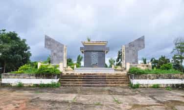
Historical relic of the Ba To uprising
The Ba To uprising broke out on March 11, 1945 with 278 guerrilla members, two days after Japan overthrew the French in Vietnam, establishing a new government in Ba To district and Quang Ngai province. The Ba To uprising was associated with the Ba To Guerrilla Team, the first armed organization of the people of Quang Ngai province directly organized, trained and led by the Communist Party of Vietnam. The Ba To guerrilla team is one of the revolutionary armed forces born in the pre-uprising period and became the core force of the revolutionary masses in Quang Ngai during the days of the general uprising in August 1945, contributing part in building revolutionary armed forces in Thua Thien - Hue and the South Central region. Many members of the Ba To Guerrilla Team later became talented officers and excellent generals of our army in the two resistance wars against the French and the Americans. In 1980, the complex of relic sites about the Ba To uprising and the Ba To guerrilla group was recognized as a national historical and cultural relic by the Ministry of Culture and Information. In 2010, the Ba To Guerrilla Team was awarded the title of Hero of the People's Armed Forces during the anti-French period by the State. Accordingly, the special national relic site of the Ba To uprising includes 11 locations:. 1. Lieng river section (Ba To town), behind Ba To station, where revolutionary soldiers pretended to have tuberculosis, demanded to live in isolation under boats, covered the enemy's eyes to print leaflets and propaganda materials Revolution. 2. Nuoc Nang brick kiln (Ba To town), where the Quang Ngai Provincial Party Committee was established at the end of December 1944. 3. Comrade Tran Quy Hai's house (Ba To town), where the Provisional Provincial Party Committee held an extraordinary meeting (March 10, 1945) to decide to rebel and seize power. 4. Suoi Loa watchtower (Ba Dong commune), where the Quang Ngai Provincial Party Committee held an emergency meeting at noon on March 11, 1945 to decide on the direction of the uprising to seize power in Ba To district capital. 5. Ba To station, the garrison of the army commanded by the French station chief, controlling Ba To district, was captured by insurgents on the night of March 11, 1945. 6. The Procuracy Department (Ba To town) is where on the night of March 11, 1945, rebel forces rounded up Procurator Bui Danh Ngu, confiscating all seals, records, documents, and weapons; take power back to the people. 7. Ba To Stadium (Ba To town), where the Ba To guerrilla team was founded and where on the morning of March 12, 1945, the Uprising's Steering Committee organized a large rally, declaring He abolished the feudal colonial government and established a revolutionary government. 8. Hang En beach (Ba Vinh commune), at the foot of Cao Muon mountain, is where on the night of March 14, 1945, the Ba To guerrilla team held the oath "Sacrifice for the Fatherland!". 9. Ben Buon (Ba Thanh commune), this is the place to receive food and weapons donated by lowland people, transported by river to supply Ba To guerrillas to build an anti-Japanese war zone in Fig Juice, Leaf Juice. 10. Nuoc La War Zone - Voot Rep Cave (Ba Vinh commune), where the Ba To guerrilla group stationed troops, built a base, and practiced military resistance against the Japanese. 11. Cao Muon Mountain War Zone (Ba Vinh commune), one of the places where the Ba To guerrilla team based itself in the early days of the uprising, building forces and cultivating Kinh-Thuong solidarity. In August 2013, the Prime Minister decided to recognize the communes: Ba Vinh, Ba Giang, Ba Dong, Ba Chua, Ba Thanh and Ba To town as belonging to the "Central Safety Zone in Quang Ngai" during the anti-French period. On December 25, 2017, the Prime Minister decided to recognize the locations of the Ba To uprising as "Special National Monuments". Source: Collection of national monuments
Quang Ngai
8562 view
Rating : Special national monument

Memorial house of late Prime Minister Pham Van Dong
Memorial area of Prime Minister Pham Van Dong in Duc Tan commune, Mo Duc district, Quang Ngai. Where many high-ranking delegations from the Party and state, from Quang Ngai province and the people of the country, international friends come to commemorate and learn about Prime Minister Pham Van Dong. Prime Minister Pham Van Dong was born in Thi Pho Nhat village. Since 1925, he participated in the student movement fighting for the French to release Phan Boi Chau, and mourned Phan Chau Trinh. In 1926, he participated in a training course organized by Nguyen Ai Quoc and was admitted to the Vietnam Revolutionary Youth Association. From then on, young man Pham Van Dong embarked on the revolutionary path. The August Revolution was successful and he held the position of Minister of Finance. During the years of resistance against the French, he was a representative of the Party Central Committee and the Government in the South Central region. In 1949, he was appointed Deputy Prime Minister and from September 1954 also served as Foreign Minister and Head of the Central Foreign Affairs Commission. Then from September 1955 to December 1986, he held the position of Prime Minister. Tourists often stop for a long time at the artifacts of the late Prime Minister's daily life. A bike. One suitcase. Coffee box containing rice. Mr. Nguyen Tan Van, Former Vice Chairman of the People's Council of Mo Duc district, Quang Ngai province shared his thoughts: I visited the souvenir area many times, stopped for a long time at the bicycle and the rice cart with 4 food boxes when going. work and was touched by Uncle Ho's simplicity. Prime Minister Pham Van Dong always mingles with the people, sticks with the people, shoulders the burden, and leads the Vietnamese revolution through extremely difficult historical periods. In every position and responsibility, the Prime Minister has completed his duties excellently. During the years of resistance against the French, as a representative of the Party Central Committee and the Government, Pham Van Dong, along with martyrs Huynh Thuc Khang and Nguyen Duy Trinh, directed the fight against the French to maintain the freedom zone of Inter-Region 5. Especially , an extremely astute person in foreign affairs, was the head of the delegation of the Government of the Democratic Republic of Vietnam to the Fontainebleau Conference in France in 1946, and the head of the delegation to the Geneva conference in 1954. Although, busy Busy with national and people's affairs, Prime Minister Pham Van Dong always cares about the young generation and the country's education cause. Educate and cherish the future generations of the country and the nation. During 75 years of revolutionary activities, 41 years as a member of the Party Central Committee, 35 years as a member of the Politburo, 32 years as Prime Minister, 10 years as Advisor to the Party Central Committee, Prime Minister Pham Van Dong has made many great contributions. Prime Minister Pham Van Dong's life is a life of commitment to the revolutionary cause of the Party and the nation. The 115th birthday anniversary of Prime Minister Pham Van Dong is another time to remember and pay tribute to the contributions of the Prime Minister who always lives in the hearts of the people. Source: Quang Ngai province website
Quang Ngai
8482 view
Rating : National monument

Mang Den historical relics and landscapes
Mang Den eco-tourism area is located in Mang Den town, Kon Plong district, Kon Tum province. Mang Den is a cluster of enemy strongholds, located on Road 5 from Kon Tum to Quang Ngai, now Highway 24, about 55 km northeast of Kon Tum city. This is a cluster of enemy bases deep in our liberated area. Surrounding the base is a complex system of dense obstacles with 10 layers of barbed wire and 2 layers of fence. Alternating between the layers of fence are anti-infantry mines, anti-tank mines and a trough-shaped trench 4m wide, 2.5m deep, densely planted with spikes. Inside were hundreds of blockhouses made of reinforced concrete and earthen wood, with tunnels connecting the fortifications and three corners with three mother blockhouses made of solid reinforced concrete. In mid-1974, the Kon Tum Provincial Party Committee and the B3 Command advocated attacking and destroying enemy bases to expand the liberated area and create momentum for the temporarily occupied Kon Tum area. After a period of preparation, at exactly 5:30 a.m. on October 3, 1974, the Commander of the 28th Infantry Regiment, Division 10, Army Corps 3 ordered to open fire to attack the enemy headquarters. At 7:55 a.m., our firepower simultaneously hit all targets. After a short time of developing the attack, at 10:45 a.m. we completely took control of point M12. Faced with the attack power of the H16 and H29 forces, the main force of the 28th Infantry Regiment and a number of our technical troops, on October 12, 1974, the enemy's last stronghold was located deep in the settlement area. The project in the Northeast of Kon Tum was completely wiped out. With the Mang Den victory in October 1974, our troops destroyed the enemy's last stronghold deep in our liberated area, breaking the enemy's safe corridor in the north of Kon Tum town, causing enemy troops to in the Northern Central Highlands battlefield was under strong threat. This victory liberated thousands of people and a large area of land, which was a great encouragement to promote the revolutionary actions of the people, especially ethnic minorities; At the same time, consolidate and build strong local government and armed forces. On the verge of victory, the armed forces surrounded the district capital of Mang But, liberating all the people in the area. Along with the victories at Dak Pet and Mang But bases, the Mang Den victory contributed to expanding the liberated area to Kon Tum town, creating new position and strength for the Central Highlands campaign, paving the way to liberate Saigon. , successfully ending the historic Ho Chi Minh campaign, unifying the country. Mang Den historical and scenic area was recognized as a national historical and scenic site on April 13, 2002. Source: Kon Tum Tourism
Quang Ngai
8195 view
Rating : National monument

Son My relic site
Son My relic site, located next to Highway 24B, belongs to Tu Cung village, Tinh Khe commune, Son Tinh district, Quang Ngai province. This is a place to preserve evidence of the scene, as well as a place to display images, artifacts and place a monument commemorating the 504 victims of the Son My massacre, also known as the My Lai massacre. Son My is the name the Saigon government gave to Tinh Khe commune, while My Lai is the spelling in military documents and maps, and later in the American press, to designate Tinh Khe commune. This name originates from the name of My Lai village, one of the four villages (hamlets) of Son My. Pinkville (Pink Village) is also another name for Son My used by the US military as a nickname in combat maps. The Son My massacre occurred on March 16, 1968, on February 18, Mau Than year, according to the lunar calendar. The main unit that caused the bloody event that shocked world public opinion was the 1st platoon, 11th brigade, Army division, American expeditionary force. On that "terrible morning", after heavy rounds of artillery shelling the village, American troops landed by helicopter on the fields west of Tu Cung hamlet and Go hamlet (Co Luy hamlet) in Tinh Khe commune. The insanely brutal and destructive massacre began with American soldiers hunting down and shooting civilians. Houses and shelters were destroyed, burned, and cattle were shot and killed. The climax of the brutality was the gathering of villagers, mostly old people, women and children, into groups and then shooting and killing. 102 people were killed at Watchtower, 170 others were shot in a ditch east of Thuan Yen hamlet, Tu Cung hamlet. American soldiers did not encounter any reaction from the "enemy" side, other than the screams of panic and pain from innocent victims. Their only loss in personnel was when black soldier Herbert Carter shot himself in the leg to avoid participating in the massacre of his fellow men. Horrifying truth:. In just one morning, 504 innocent civilians were killed (407 people in Tu Cung village, 97 people in My Hoi village), including 182 women, 173 children, and 60 elderly people. There were 24 families killed, 247 houses burned down. Immediately after the massacre, the National Liberation Front Committee at all levels and the Government of the Democratic Republic of Vietnam spoke out to denounce the crimes of the American expeditionary force before domestic and foreign public opinion. However, it was not until a year and a half later that this horrifying event was revealed in America by American journalists and veterans. Americans and the whole world were shocked. The movement opposing America's involvement in Vietnam spread widely. Many prestigious figures, intellectuals, and social activists in the US and many parts of the world demand that leading figures in the White House and the Pentagon be put on trial for war crimes. After the liberation of the South, the revolutionary government protected the remaining evidence after the massacre, built a memorial for the victims and a house displaying pictures and artifacts related to the Son My massacre. In Thuan Yen hamlet, Tu Cung hamlet, next to the water canal that was once red with the blood of 107 victims who were collectively murdered. After many restorations, the evidence area now has an area of 2.4 hectares, including two main areas: the field evidence area (west) that has been preserved and restored and the additional exhibition area and statues. memorial, reception house (east). In addition, there are relics related to the massacre in Tu Cung village and My Lai village. There are documentary films recording the stories and images of survivors, and many scrapbooks that visitors have written in in many languages, truly expressing the feelings and attitudes of many people. people, of many generations, many different religions, ethnicities and political trends, when learning firsthand about the Son My massacre. Source: Quang Ngai Electronic Newspaper
Quang Ngai
8149 view
Rating : National monument

Sa Huynh culture
Sa Huynh culture is an archaeological culture of the Metal Age, formed at the peak of civilization in the Iron Age dating from 500 BC, ending in the second century AD, originating from formed and developed from the previous pre-Sa Huynh cultures of the Early Bronze and Middle Bronze Ages. The distribution of Sa Huynh Culture is in Central Vietnam, the North intersects with Dong Son Culture in Quang Binh, the South intersects with Dong Nai Culture in Binh Thuan, the West is the edge of the Central Highlands, the valley area. East of Truong Son, the east reaches out to the island near the shore. The basic burial formula of the Sa Huynh Culture is tombs with jars buried in large cemeteries. At the same time, jar tombs and earthen tombs are also found at burial sites of the Sa Huynh Culture. Typical jewelry of the Sa Huynh Culture are two-headed animal earrings, three-pronged earrings, agate beads, bracelets made from gems, glass, and sea mollusk shells. Glass making and iron smithing are outstanding achievements of Sa Huynh civilization, playing an important role in promoting the development of Sa Huynh society. Sa Huynh culture has extensive exchanges with other cultures in mainland and island Southeast Asia. Sa Huynh cultural special national relic is a type of archaeological relic, with 6 relic sites including:. An Khe Lagoon, An Khe Creek - Cua Lo River, Phu Khuong, Long Thanh, Thanh Duc, Champa Relics Complex. The two locations Long Thanh and Phu Khuong have been decided by the Ministry of Culture and Information to be ranked as National Historical and Cultural Monuments. 1. Location of Long Thanh relic. Long Thanh relic site (also known as Go Ma Vuong) belongs to Long Thanh 2 residential group, Pho Thanh ward, Duc Pho town. Long Thanh is a pre-Sa Huynh relic of the early Bronze Age, the direct origin of the development of the Sa Huynh Culture of the early Iron Age. Long Thanh relic stands out with its egg-shaped and spherical jar coffins, with lids that are covered with bowls or pot tombs with two pots buried face down. The collection of artifacts features cat tongue-shaped stone picks, buffalo tooth-shaped stones, and nephrite gemstone jewelry including 4-point earrings, scarf-shaped earrings, bamboo-shaped chains, and shaped chains. The pillar is elaborately and delicately crafted. The Long Thanh artifact collection is notable for its ceramics. Long Thanh's ceramic containers are diverse in type and rich in pattern. Long Thanh relics are characterized by an early period, representing a cultural stage of the early bronze age progressing to the early iron stage of the Sa Huynh Culture. 2. Location of Phu Khuong Relics. Phu Khuong relic is a very large Sa Huynh Culture jar tomb, distributed on a large sandy plain of Sa Huynh sand dunes along An Khe lagoon, in Phu Long village, Pho Khanh commune, Duc Pho town. Relics belonging to the early Iron Sa Huynh period, jar tombs are always buried in clusters on sand dunes along the coast, next to freshwater lagoons and therefore somewhere nearby are the residential relics of the owners of the jar tombs. Phu Khuong. Inside the jars are many burial items, some jars contain human remains, burial relics in the jars include pots, bowls, ceramic vases, iron objects, jewelry including earrings, glass bracelets and semi-stones. precious. Phu Khuong relics are characterized by precious stone jewelry, which are dark red beads made of agate stone with many shapes such as flat squares, diamonds, diamonds, hexagonal polyhedrons, and bowls. sense. 3. Location of Thanh Duc Relics. Thanh Duc relic is the tomb site of Sa Huynh Culture jars distributed on the Sa Huynh sand dunes, between one side is the sea and the other side is the salt water lagoon of Tan Diem salt flat area, belonging to Thanh Duc residential group, Pho Thanh ward. , Duc Pho town. Thanh Duc jar tomb area has a very large number of burial jars, if we count the total number of jar tombs excavated, it reaches 175 jars. The jar contains burial relics such as bronze objects, iron tools, nephrite stone jewelry and earrings, and many ceramic containers. Thanh Duc bronzes have bronze rattles, this is evidence of exchange between Sa Huynh Culture and Dong Son Culture. Especially in Thanh Duc, there are bracelets made of copper and iron combined. This is a unique relic found for the first time in the Sa Huynh Cultural relic. 4. Champa relic complex in Sa Huynh space. The Champa relic complex in Sa Huynh space includes: Mot Mountain Tower, Go Da Tower, Stone Bridge, Champa Temple (Temple of Tho Chu), Champa inscriptions, Champa well system, ancient stone folding road (Sa Huynh - Champa - Vietnamese), Champa ancient irrigation ditch system. Regarding the current status: Champa towers such as Mount Mot tower only have ruins of the base of the tower left. Go Da Tower has traces of its base located next to Thien Ly route. Ancient stone roads, ancient irrigation ditches, and ancient stone bridges are still intact. 5. An Khe Lagoon. An Khe Lagoon is located next to National Highway 1A, in Pho Khanh commune, Duc Pho town, Quang Ngai province. An Khe Lagoon has outstanding value as the largest freshwater lake next to the sea in Vietnam, a transition place for terrestrial and marine ecosystems, coexisting in an overall ecosystem of freshwater, brackish water, and freshwater. salinity and agricultural production, playing an important role in the environment and socio-economic development of the region. 6. An Khe creek, Cua Lo river. To the east of An Khe lagoon, there is a small narrow creek draining into the sea with an area of 58.5 hectares. At the end of the creek is the lagoon mouth - local people often call it Cua Lo, this mouth is almost closed all year round. An Khe lagoon, creek and Cua Lo river are associated with the formation of Sa Huynh Culture, and are the basic natural conditions for the formation of Sa Huynh Culture, Champa Culture and Vietnamese Culture relics in the surrounding area. dress. Source: Duc Pho town cultural and sports information center
Quang Ngai
8063 view
Rating : Special national monument

Dang Thuy Tram Hospital
Martyr - Doctor Dang Thuy Tram was born on November 26, 1942, a son of his hometown Thua Thien Hue, born and raised in Hanoi. Father is surgeon Dang Ngoc Khue, mother is Pharmacist Doan Ngoc Tram - former lecturer at University of Pharmacy, Hanoi. In 1966, after graduating from Hanoi Medical University. Dang Thuy Tram brought with him the strength of youth, the will to fight, and the ambitions of youth, volunteering to accept the duty of a physician in the Southern battlefield. Her working place is Duc Pho district hospital, Quang Ngai province. While on duty in the area, she was ambushed by the enemy and heroically died in 1970 at a very young age, just under 28 years old with 3 years of professional experience and 2 years of Party life. Local people buried her right on the land where she sacrificed and her family reburied her at the Martyrs cemetery in Xuan Phuong commune, Tu Liem district, Hanoi capital. Dang Thuy Tram relic area includes: Dang Thuy Tram Clinic in Pho Cuong commune, Duc Pho district and historical relics associated with Dr. Dang Thuy Tram's activities during the war such as: Forward surgical station in Bong Dau mountain, Quy Thien village, Pho Khanh commune. Secret bunker in the garden of physician Ta Thi Ninh in Nga Man village, Pho Cuong commune. Duc Pho clinic at Go Chay hill, Dong Ram 1 village, Ba Kham commune. Duc Pho Clinic in Nuoc Dang village, Ba Trang commune, Ba To district. Dang Thuy Tram Clinic is located right next to National Highway 1A, about 50km south of Quang Ngai city. The clinic was built according to the wishes of Dr. Dang Thuy Tram during his lifetime. This is the first medical examination and treatment model with a special model in the nationwide community health care and examination system. In addition to performing medical examination and treatment for people in the area, the clinic is also an address that attracts tens of thousands of visitors each year. Dang Thuy Tram Clinic was built on an area of 3,900m², with architecture following the style of Rong house - Central Highlands so that visitors can feel the closeness and friendliness. Palm rows along the walkway and front porch make the clinic look like a resort with a garden. Prominent on the main campus is the monument of Hero and Martyr - Doctor Dang Thuy Tram, holding a hat to cover his head, striding forward, as if rushing through the forest while on duty, looking for a new location. It was safer to build an infirmary to treat wounded soldiers and avoid enemy raids. In addition to the treatment area, the clinic also has a separate display area introducing artifacts and images related to Heroes and Martyrs - Doctor Dang Thuy Tram in particular and the revolutionary struggle tradition of the Duc Pho people. (Quang Ngai) and Zone 5 in general. In particular, in the exhibition hall are the luggage left behind by Doctor Dang Thuy Tram before his death, which are two diaries that were picked up on the battlefield by an American veteran named Frederic Whitehurst, a former US military intelligence officer. and kept for 35 years until it was returned to the author's family at the end of April 2005. Due to difficulties in finding Doctor Dang Thuy Tram's family and seemingly despair, 2 diaries This document was donated by Frederic Whitehurst to the Vietnam Archives Institute at the University of Texas, Lubbock for storage and preservation. These two diaries were later published by the Writers' Association Publishing House as a book titled "Dang Thuy Tram's Diary". The works were successively translated into many languages and published in many countries, making the image of Dr. Dang Thuy Tram familiar to international friends, becoming a shining symbol of the spirit of fighting against injustice. hidden and the desire for peace of the young generation of Vietnam. It can be said that with the far-reaching influence of Dang Thuy Tram's diary, it is one of the bright examples for spiritual education and revolutionary heroism in modern times... That is why today the Dang Thuy Relic Area Tram is a very famous attraction for young people every time they have the opportunity to visit Quang Ngai. Source: National Museum of History
Quang Ngai
6899 view
Rating : National monument

Plei Kan victory
Plei Kan is located in Ngoc Hoi district, Kon Tum province. It is located in the north of Kon Tum province, on the eastern slope of the Truong Son range. A special feature of Plei Kan is that it is located at the crossroads of three countries: Vietnam, Laos and Cambodia. Plei Kan has an important history during the Vietnam War. Before 1965, Plei Kan was a large village of the Xe Dang ethnic group and other ethnic groups such as Brau, H Lang, and Kdong. Its strategic geographical position was recognized at the end of 1964 when the US decided to build a cluster of military bases here. Plei Kan in the language of the Xe Dang people is "big village". Before 1965, this was a place where the Xe Dang and Brau people lived in harmony in a peaceful village at the cross-border area of the three countries Vietnam - Laos - Cambodia. At the end of 1964, realizing the important strategic position at the Indochina border junction, the US puppet implemented a policy of gathering people to set up hamlets to isolate the people from the revolutionary forces, herding people to Dak Rnang village (Tan Canh, Dak To) established a strategic hamlet. In 1966, the US built Plei Kan into a military base located in the Indochina junction area (we often call it Plei Kan Base) to block the attack of our main army from the North and from Laos and Cambodia. The entire base has areas A, B, C, D, E, arranged continuously on 5 hills separated by 600 - 1,000 meters. In particular, area A is the central area. There is a tank detachment, a military airport, a field airport, 155mm and 105mm artillery positions, a system of underground bunkers, bunkers, hospitals, warehouses... The base is surrounded by 8 to 12 layers of barbed wire. Since 1969, here, there have been regularly 450 - 500 border rangers (95th Border Ranger Battalion) and 2 artillery companies of E 42 (Division 22) of the puppet regime. In early October 1972, the Central Highlands Front Command assigned the 10th Division the task of destroying Plei Kan Base. The 66th Regiment, the 37th Special Forces Battalion and most of the Division's artillery were ordered to attack. At 10:00 a.m. on October 12, 1972, from the surrounding artillery positions, our artillery continuously opened fire. All types of D74, 105mm, 155mm DKZ, B72 artillery, 106mm mortars... simultaneously bombarded targets in the base. Under the support of infantry, artillery and special forces, they cut the fence and opened the door. At 11:00 a.m., with strong support from artillery, tanks and infantry, we heroically rushed forward to capture the targets. The fighting in the base was extremely fierce. We and the enemy fought over each bunker, bunker, fortification... With a brave and tenacious spirit, after nearly a day and night of fighting, by dawn on October 13, 1972, we had complete control of Plei Base. Kan. As a result, we killed 404 enemies, captured 65, shot down and destroyed 6 aircraft, captured 6 105mm guns, 2 155mm guns, 4 tanks and the entire ammunition warehouse. With the victory at Plei Kan Base, we have completed the liberated area north of Kon Tum, opened the Indochina border corridor, and our strategic transportation route from the great rear of the North to support the battlefield. The South via the Ho Chi Minh Trail became a solid continuous system and liberated tens of thousands of people. Today, the Plei Kan victory relic site is located on the Ho Chi Minh Highway, in Dak Xu commune (Ngoc Hoi district). Plei Kan Victory Historical Relic was ranked at National level on May 15, 2024. Source: Kon Tum province electronic information portal
Quang Ngai
6270 view
Rating : National monument

Kon Tum Prison
"Kon Tum Prison" is located at Truong Quang Trong Street, Quyet Thang Ward, Kon Tum City. "Kon Tum Prison" reflects an early historical period of the movement to fight against invaders in our country. Kon Tum Prison was built by the French colonialists from 1905 to the end of 1917. Kon Tum Prison was built next to a large ditch next to the prison on the East-North side of Street 14 (now Phan Dinh Phung Street - Ho Chi Minh Highway running through Kon Tum city); West - South is the green loincloth soldier station; East - South is the embassy, the puppet leader's palace, and the Police Department. They placed Kon Tum Prison under siege and isolation. To facilitate control, they dug a deep trench 150m long, 100m wide, designed four rows of houses in a box shape (square) with an area of about 2.5 hectares, four corners of the prison had 4 bunkers built up, guarded day and night. secure room. The prison is built in the style of the old French fortress Vauban (Vo-ice) of the 17th century. The roof is tiled, the walls are made of whitewashed tocsi, the four sides are not covered by walls like other prisons, four cells are vertical and horizontal. built together into a square, each 18m side has a door and two high huts so the guards can observe inside and outside the prison; In the middle is a small, narrow square yard, the width of a row is 3.5m, of which 2m is laid with planks, 1.5m is a path, people lying on the plank floor can see outside the yard. Kon Tum Prison is a place to detain political prisoners escorted by the French colonialists from Nghe An, Ha Tinh, Thua Thien Hue, and is also a place to provide workers to explore the plateau and open Road 14. According to numbers According to records, this place held about 500 political prisoners and nearly half of them died. Specifically, during the 6-month process of building Road 14, the French colonialists exploited prisoners of war's labor to the point of exhaustion, leading to the death of 210 people in this place. During the years of resistance against the French, Kon Tum prison was considered the most brutal killing place. Kon Tum Prison was once the site of many protests by communist soldiers to protest against forcing prisoners to build roads in Dak Po. Although the protests here were all brutally massacred by the French colonialists, this sacrifice made them admit defeat and was forced to close in 1935. It can be said that Kon Tum prison is proof of this. denouncing the barbaric crimes that the French colonialists committed against our people in the period 1930 - 1931. At the same time, this is also a symbol of the resilience and indomitable struggle to protect the Fatherland of communist soldiers. in Kon Tum land. In 1975, when the war ended, Kon Tum prison became a historical relic of South Vietnam. After the ruins of the war, today only the graves and memorial stele of 8 revolutionary soldiers remain. In 1990, Kon Tum prison was recognized as a national historical and cultural relic site. Source: Kon Tum province electronic information portal
Quang Ngai
6214 view
Rating : National monument

Dak To victory relic - new scenery
The Dak To - Tan Canh victory shook the entire US-Puppet defense system in the Central Highlands, expanding the liberated area and with the Quang Tri victory, the Southeast region created a new situation in the war. Southern school, contributing to defeating the strategy of "Vietnamization of the war", "Nich Son Doctrine" in Indochina, forcing the US to sign the Paris Agreement to withdraw troops from Vietnam. The Central Highlands is an important strategic area of the region. Among them, Kon Tum is the northern tip of the Central Highlands, located at the intersection of the Vietnam - Laos - Cambodia border; connecting the North - South corridor and the corridor between East and West Truong Son. With this important geopolitical position, the US empire and the Saigon puppet government have concentrated all forces to build the North Kon Tum region into the most solid defense area in the Northern Central Highlands, centered on Dak To - Tan Canh defense cluster. From 1957 to 1972, the US-Puppet built in Dak To - Tan Canh the most solid defense system including base E42 in Tan Canh and base Dak To 2. Therefore, Dak To - Tan Canh The scene became the site of many fierce battles between us and the enemy. In particular, many major campaigns were carried out here such as: Dak To 1 Campaign in 1967, the Central Highlands armed forces destroyed part of the 4th Infantry Division, the 1st Airborne Cavalry Division and The US 173rd Airborne Group at height 875 contributed to the General Offensive and Uprising of Mau Than in 1968, Dak To Campaign 2 in 1969, we destroyed many enemy forces, contributing to defeating the local war strategy. Ministry and the US "search and destroy" plan on the Central Highlands battlefield and especially the 1972 Spring-Summer campaign in the Northern Central Highlands, the focus of which was the liberation of Dak To - Tan Canh. Implementing the guiding policy of the Politburo and the Central Military Commission, our units decided to open the Spring - Summer 1972 campaign with the aim of "Destroying the enemy, liberating Dak To - Tan Canh, if conditions permit, liberate Dak To - Tan Canh". release Kon Tum town. The development direction may be in the direction of Plei Ku; if conditions permit, expand the liberated area west of Plei Ku, liberate Buon Ma Thuot town, forming a complete base connected to the base. Southeast region". Kon Tum Party Committee has mobilized maximum local army forces, guerrillas, and civil servants to coordinate with the main force of B3 and Zone 5 to participate in the campaign. On the enemy's side, the total number of enemy forces deployed in this area amounted to 28 infantry battalions, 6 artillery battalions, 4 armored battalions. The enemy was determined to concentrate their forces to form a solid defense line. prevent the liberation army from taking over the Central Highlands. With the concentration of forces and careful preparation, the two sides created a fierce, fierce battle with complete victory in favor of the liberation army. At exactly 11:00 a.m. on April 24, 1972, the liberation flag given by the Kon Tum Provincial Party Committee to the 66th Regiment on the day of the departure ceremony was carried into battle by our soldiers and fluttered atop the center of the enemy base. , announced the liberation. The Dak To - Tan Canh defense group, which the US and Puppet dubbed the "steel belt" in the Northern Central Highlands, was completely destroyed by our troops. The victory of Dak To - Tan Canh along with the victory of Quang Tri and the Southeast region were campaigns that had extremely important strategic significance. They created a new situation on the Southern battlefield, contributing defeated an important strategic step of "Vietnamization of the war" and "Nich Son Doctrine" in Indochina, forcing the US to sign the Paris Agreement and withdraw troops from Vietnam. With the determination "Truong Son transforms - Po Ko rises up, wipes out the enemy, liberates Dak To", "All for the front line, all to defeat the American invaders", the people of all ethnic groups in the region Kon Tum province has mobilized maximum human and material resources for this campaign. The "revolutionary noodle fields", "liberation noodle fields", "the sound of pestles pounding rice" all night long... providing food for the front lines or the image of a mother "Holding a gun in her hand, carrying her baby in front, carrying bullets on their backs" of the Kon Tum People of all ethnic groups will forever become a noble symbol of the will of all for lives, for national independence and the desire for peace. With profound historical significance, in 2017 "Dak To - Tan Canh Victory Site was recognized by the Prime Minister as a special national relic. Source: Propaganda Department of Kon Tum Provincial Party Committee
Quang Ngai
6156 view
Rating : Special national monument

Bac Ai Pagoda
Bac Ai Ancestral Pagoda is located on Mac Dinh Chi street, Quyet Thang ward, Kon Tum city. The pagoda was built in the 8th year of Bao Dai (ie 1932 to 1933). Located on a high ground, the pagoda faces south, following Hue architectural style, Mon-shaped, including the Main Hall, Dong Lang, Tay Lang and Three Entrance Gate. Leader Vo Chuan, designed and urged both Kinh people and ethnic minorities to explore the jungle hill to build a pagoda, designed in the style of the word "Mon". In the year of the Goat, 1931, the Central provinces suffered consecutive droughts and crop failures, and people were hungry. Therefore, in the late years of 1931 and 1932, immigrants from the provinces of Hue, Da Nang, Quang Nam, Quang Ngai, and Binh Dinh flocked to the highlands and Kon Tum. During this migration, 70% died of starvation along the way, the remaining 30% reached the promised land. They cleared the forest for farming, but in this place they encountered many unforeseen things: wild animals, raging cobras biting countless people to death, people were confused and scared, night and night in this land, things happened. Many scary phenomena occurred. In 1932, Director Vo Chuan invited Mr. Hoang Thong, head of Bach Sa Pagoda, Quy Nhon, and the monks to go to Kon Tum to fast for 3 days to pray for the souls of unjustly deceased people. After the funeral ceremony, Mr. Vo Chuan asked Mr. Hoang Thong to prove his name Bac Ai. Charity is immense love, regardless of religion, Kinh people or Upper people. The pagoda was given the sign "The Four Bac Ai Tu" by King Bao Dai in 1933. In 1990, the pagoda was restored with the organization of the Venerable Abbot Thich Chanh Quang. Looking at the overall architecture, Bac Ai Patriarch Pagoda was built in the North-South direction, in Mon style, opening for that direction is the three-entrance gate, leading to the main hall in the center and the left and right sides are Dong Lang and Dong Lang. Tay Lang. The main hall consists of 3 rooms and 2 wings. The ancient building is divided into 3 compartments: front hall, middle hall, and upper hall. The roof is tiled, the brick walls are whitewashed, and the ceiling is covered with ceilings. The rafters, rafters, and columns all use precious woods such as purple star, rosewood, and redwood, elaborately and elaborately carved by Hue artisans. This space worships Tam The Buddha, Amitabha Tam Ton, Hoa Nghiem Tam Thanh... In particular, there is a stele recording the merits of French Captain Quenin and a wooden pillar symbolizing the 7 skulls of a Japanese officer who committed suicide at the pagoda yard at the end of World War II. Outside the main hall is Hoa Vien, where tombstones, towers, and shrines worship the God Emperor Bon Canh, Mountain God, Doan Quan and tru house are concentrated. Through many restorations, Bac Ai Ancestral Pagoda's original architectural features have been changed, and some unique sculptures such as flanking dragons and winding ropes are no longer there. The system of worship statues is covered with a layer of bright bronze, unable to retain its pristine beauty. However, a number of precious artifacts with visual artistic value such as the Statue of the Three Holy Mother Goddesses, the Guan Yin statue made of cracked ceramic, the Hoang Phi, the Couplet, the Ordination box, the Seal, etc. are still on display. subtle traces of time. Currently, Bac Ai Ancestral Pagoda is one of three communal houses (Vo Lam Communal House, Trung Luong Communal House, Bac Ai Ancestral Temple) that have been recognized by the People's Committee of Kon Tum Province as a historical-cultural relic. provincial level Source: Kon Tum Tourism
Quang Ngai
6096 view
Rating : Provincial level relics